
Colton Block Lookup Sources
A block-scale search works by combining geographic, property, historical, and community layers. No single source supplies a current list of everyone around an address. The parcel viewer shows shapes and APNs. City maps show district and service context. Permits show public project roles. Census pages and directories show dated occupants. Planning notices show a project or meeting, not a membership roster. The table keeps each source's contribution visible.
| Source | What it shows about a block | Access |
|---|---|---|
| County parcel viewer | Adjoining parcel shapes, APNs, and situs labels | Free map browse |
| Assessor Parcel Access | Assessment facts, displayed owner or assessee, mailing contact | Free public property search |
| City maps | Historic, zoning, council, utility, and service geography | Free PDFs and web maps |
| eTRAKiT permits | Project, applicant, contractor, inspection, and planning clues | General search; detail may need login |
| 1950 and earlier census | Household sequence and nearby households for a dated year | NARA or library access |
| Directories and telephone books | Listed occupants, subscribers, businesses, and addresses | Library or catalog collection |
| Planning notices | Project-specific neighborhood meeting or contact information | City web page |
Use a source for what it actually records. An owner is not automatically a neighbor in the household sense, and a civic contact is not proof of membership.
Clicking Adjacent Colton Parcels
The San Bernardino County public assessor map is the practical block tool. Start with the subject address or APN. Zoom until parcel boundaries and labels are clear. Select the target polygon, note its APN, close the popup, and click each immediately adjoining polygon or pan along both sides of the street. This creates a geographic list of parcels without claiming that every parcel is a separate household.
The process is address to map, map to APN, APN to parcel facts, and parcel facts to the appropriate custodian. For a full named-street chain, the Colton street directory adds recorder, permit, and historical address methods. The neighbor lookup stays closer to the target block.
- Locate the subject parcel and save the map date, address, and APN.
- Click each polygon that shares a boundary or sits immediately across the street.
- Check each APN in Parcel Access and separate situs, mailing, owner, and assessment fields.
- Use city maps to add council, zoning, historic, flood, or utility context.
- Use a permit, directory, or census source only when a dated person or project question remains.
The official research did not document a live radius or buffer export. Build the block by visible parcels and record the method.
APNs Are Not Colton Households
An APN identifies land for assessment. It does not enumerate every household, guest, utility customer, or unlisted occupant. The parcel card may show a displayed owner or assessee, tax mailing address, legal description, values, exemptions, characteristics, and map geometry. A mailing address can point away from the parcel. An exemption does not prove occupancy. A neighboring owner can be a useful property contact without being a nearby resident.
| Parcel fact | Careful interpretation |
|---|---|
| Situs | Where the parcel is physically located |
| APN | County identifier for the mapped land unit |
| Mailing address | Where tax correspondence is sent |
| Owner or assessee | Assessment role when publicly displayable |
| Legal description | Land identity for recorded instruments |
Keep the claim narrow. A block lookup can say that a parcel is adjacent and that a public record connects a name to it. It should not rewrite that fact as a complete list of Colton neighbors.
Colton GIS Layers and Limits
Map layers help explain why a block feels different from the postal label. Colton maps include council districts, general-plan and zoning material, historic districts, electric service area, FEMA flood zones, benchmarks, bicycle lanes, and street-sweeping information. The county parcel viewer supplies the land polygons. Together they can show jurisdiction, service geography, and the public context of a project.
Layers are not names. No official buffer or radius export was documented in the research, and no public neighborhood membership directory was located. Use the map to define a block, then ask the city or county for an existing, narrowly described record if a planning notice, permit file, or map document needs confirmation. Do not ask an agency to create a roster of neighbors.
| Layer | Block question | Limit |
|---|---|---|
| Parcel boundaries | Which land units touch the subject | Not a household list |
| Historic district | Whether preservation context applies | Does not name residents |
| Council district | Which civic office represents the block | District contact is not membership |
| Utility service area | Which public service geography applies | Customer names are not public here |
Historic Colton Neighbors
Historical neighbors appear most clearly in census enumeration order and dated directories. A 1950 or earlier census can show the sequence of households near an address. A city directory can show a listed adult, occupation, spouse notation, telephone subscriber, or street entry. The California Room documents regional directory coverage from 1887 to 1968, while Great Registers from 1880 to 1886 reach an earlier registration layer.
Pair the sources by year. Street numbers can change, a directory can omit a household, and a census can record a household under a different name form. Use a Sanborn map, permit, deed, or newspaper notice when the block's physical layout needs confirmation. Historic neighbors are a dated reconstruction, not a current publication of names.
The strongest historical block note records the source title, page, year, address, and adjacent context. A remembered name without a citation should remain a lead.
Community Centers Across Colton
Public community facilities add a human geography layer without exposing private rosters. Hutton Center sits north of I-10 in Cesar Chavez Park. Luque Center is south of I-10 at Veterans Park. These centers can help orient a block and locate public notices or programs. Historic downtown and La Cadena, Reche Canyon, Cooley Ranch, and Agua Mansa supply other local context, while Grand Terrace and San Bernardino form important boundary relationships.
Community geography should be used as orientation, not identity inference. A nearby center does not show who lives at an address, and a postal ZIP does not establish participation. Check the complete address against city maps and the parcel viewer before attaching a public facility or district to a block.
Hutton Center
North of I-10
Cesar Chavez Park area
Public community orientation
Luque Center
South of I-10
Veterans Park area
Public community orientation
Colton Planning Notices
Project-specific meetings
City planning materials
Public notice, not a roster
Colton Civic Groups and Notices
City planning material identifies Citizens for Colton First, Rotary Club of Colton, Royal Gents Association, Colton Women's Club, Knights of Columbus council, AMIGA, and city committees. These names are useful when looking for public meeting context, organizational history, or a contact for local archives. They are not resident directories. Do not infer membership from an address, a meeting notice, or a shared name.
Planning notices can identify a project, meeting date, department, or public contact. The city's public staff directory can route a question to the City Clerk, Development Services, or Library Services. A narrow CPRA request can seek an existing notice or file. It cannot require the city to create a current list of neighbors.
| Community layer | Legitimate use | What not to infer |
|---|---|---|
| Neighborhood meeting notice | Project date, topic, planning contact | Attendance or household identity |
| Civic organization name | Historical or public contact lead | Current membership |
| City staff directory | Route a public records question | Private residence |
| Library or museum | Ask about local-history holdings | Unpublished family information |
Colton Voter Data Cannot List Neighbors
California voter information is not an open block directory. My Voter Status is an identity-gated self-check. Voter-file release under Elections Code section 2194 is purpose-limited to election, scholarly, journalistic, political, or governmental use. Street home address, phone, email, registration numbers, prior registration, driver's license or ID, Social Security number, and signatures are confidential under Government Code section 7924.000. Safe at Home and designated confidential voters are excluded.
The California voter-confidentiality statute is the source for the protected-field rule.
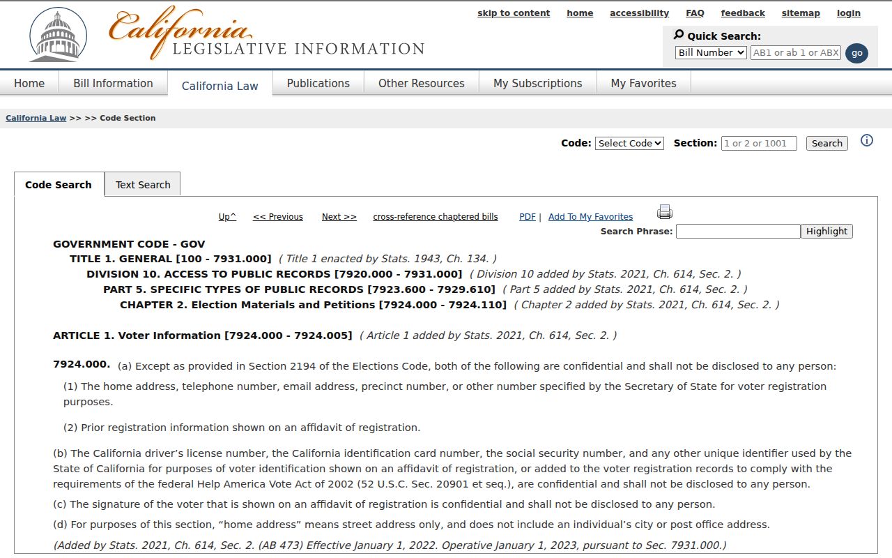
That limit is important when an adjacent parcel search looks incomplete. The missing voter name is not a prompt to infer registration from ownership, a directory entry, or a ZIP code. Use historical Great Registers only for their dated and historical purpose.
Official Records and Commercial Tools
Official records and commercial neighbor tools do different work. A county parcel map has a custodian, field definitions, and a defined purpose. A commercial tool may combine public, licensed, and inferred data, with unknown freshness and a cost or account barrier. Neither source should be treated as a full household list. Official sources deserve a direct verification step; commercial results deserve more skepticism, not a stronger claim.
| Source category | Strength | Limit |
|---|---|---|
| County parcel and recorder | Custodian, APN, legal description, indexed instrument | Ownership and parties are not every neighbor |
| City permit and planning | Project, applicant, inspection, public notice | Record role is not household identity |
| Historical directory or census | Dated occupants and nearby households | Coverage, omissions, and old numbering |
| Commercial compilation | May combine several clues in one view | Stale, conflated, inferred, or unverifiable data |
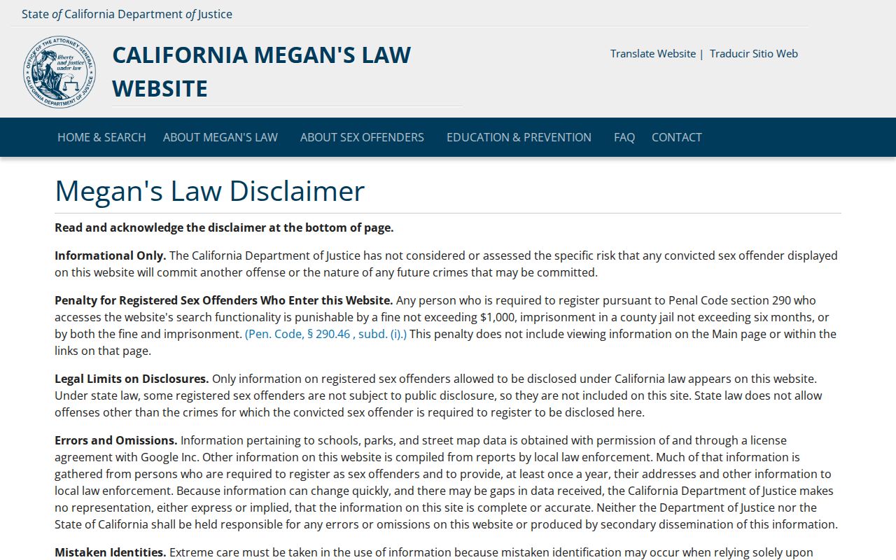
A registry page also has a narrow purpose. The California Megan's Law website carries its own search fields, map and radius functions, exclusions, and legal-use warning. It is not a general neighbor list or proof about an unlisted household member.
For a suspected scam tied to a record or address, the Federal Trade Commission fraud-reporting portal is the direct reporting channel.
Keep official verification and safety reporting separate from any commercial compilation result.
Privacy on a Colton Block
A block lookup can show adjoining parcels, public map layers, dated historical households, public project notices, and carefully limited record roles. It cannot show complete unlisted households, utility customers, delivery data, DMV addresses, or protected participants. Safe at Home supplies substitute addressing and confidential voter registration for eligible people, but it does not erase older public records.
Lawful neighbor research. Use Colton records for civic awareness, property history, family history, community reconnection, or personal safety. Do not use names, maps, or address clues to stalk, harass, intimidate, or harm anyone.
When a fact is wrong, contact the custodian that created it: ARC Assessor for assessment, Recorder-Clerk for an index or image, Development Services for a permit, the Superior Court for a case record, and elections officials for registration. A neighbor lookup is strongest when it stays modest, sourced, and dated.